Exploring geography is a core part of social studies. A well-chosen world map set can support geography lessons, world history discussions, and global awareness at home or in the classroom. The following selections emphasize durability, clear labeling, and engaging visuals to help learners of all ages understand continents, countries, capitals, and world regions. The picks below cover laminated wall posters, multi-map sets, classroom-friendly formats, and large-scale fabrics suitable for decor or educational displays.
Product Summary
The table below lists five curated world map resources selected for accessibility, durability, and educational value. All items are designed for wall display or classroom use and emphasize clear political or geographic information.
| Product | Brand | Format | Size | Key Feature |
|---|---|---|---|---|
| Laminated World Map & US Map Poster Set | Palace Learning | Laminate Poster | 18″ x 29″ | Durable, American-made laminates; includes both world and US maps |
| 2 Pack World Map Poster & USA Map Chart | Palace Learning | Laminate Poster Set | 18″ x 29″ each | Value set; two durable maps with lamination |
| World Reference & Map Forms | Evan-Moor | Book/Teacher Resource | 112 pages | Introductory reference with country data and activities |
| Large World Map Wall Tapestry | PARTH iMPEX | Fabric Wall Map Tapestry | 36″ x 56″ | Washable fabric; ready to hang; highly detailed |
| World & USA Classic Premier 3D Map Set | Swiftmaps | Laminate Poster Set | 24″ x 36″ | 3D terrain relief; dual maps (World and USA) |
Laminated World Map & US Map Poster Set – 18″ x 29″

The Palace Learning laminated poster set combines a world map with a United States map in a single wall display. The 18″ by 29″ posters are designed for classroom or home study spaces where durable, easy-to-clean visuals are needed. Laminated with a 3 mil coating, these posters resist wear from regular handling and adhesive notes. The dual-map format supports quick reference during lessons on continents, regions, and national borders. This option suits educators seeking a compact, durable, all-in-one geography reference.
2 Pack World Map Poster & USA Map Chart – 18” x 29”

This bundle from Palace Learning includes two laminated maps, both sized 18″ by 29″. Laminated surfaces ensure durability and easy cleaning in active classrooms or busy homeschool spaces. The dual-poster setup supports separate focus areas, such as a world map for global geography and a US map for state-level learning. The included lamination improves longevity against spills, fingerprint smudges, and frequent rollout or repositioning on walls.
World Reference & Map Forms

Evan-Moor’s World Reference & Map Forms offers a teacher-focused resource with country listings, area and population data, elevations, and interesting facts. It includes teacher support materials, reproducible student pages, and an answer key, making it a practical addition to lesson plans. At 112 pages, this resource complements wall maps with printable activities, ideal for study guides, worksheets, and guided practice during geography units.
PARTH iMPEX Large World Map for Wall

The PARTH iMPEX wall tapestry presents a large 36″ by 56″ world map on washable fabric. This option suits classrooms or travel-themed rooms seeking a visually striking display that can be cleaned easily. The map is designed to remain colorful and detailed under regular wash cycles, and its generous size makes it a centerpiece for geography walls. It is compatible with modern decor styles and offers flexibility for hanging in diverse spaces.
24×36 World and USA Classic Premier 3D Two Wall Map Set

Swiftmaps offers a classic two-map set with a 24″ by 36″ laminated format. The two maps—World and USA—are designed with 3D terrain relief for a tactile sense of geography. Laminated surfaces enable dry-erase use, allowing students to annotate countries, capitals, and major geographic features during lessons. The set is well-suited for classrooms that value a clear, durable, and visually engaging reference pair.
Large World Map with Flags & Capitals
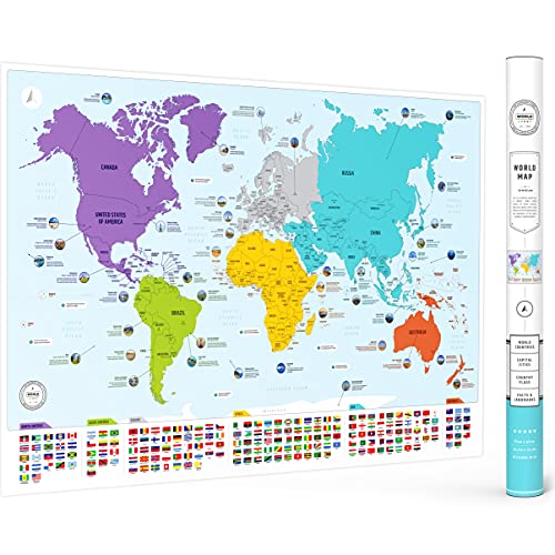
This large world map emphasizes flags and capitals with color-coded continents. It is designed as an educational tool for children and adults, highlighting political boundaries and national identities. The map’s large size (26 by 38 inches) makes it a striking focal point in classrooms or study spaces, supporting both introductory geography lessons and more advanced explorations of world regions.
US and World Desk Map (13″ x 18″ Laminated)
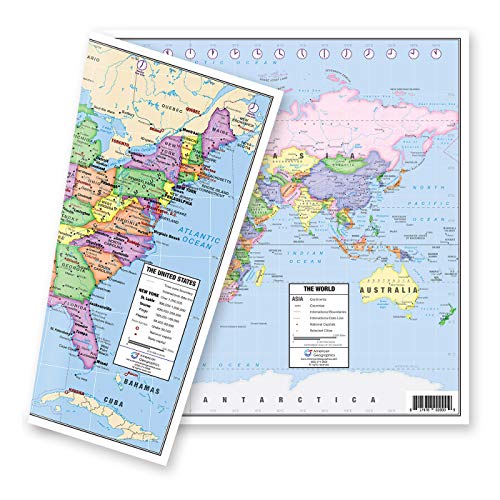
Lighthouse Geographics delivers a compact desk map with a dual-sided format. One side features a pastel US map with state details, while the reverse shows a world map with essential geography markers. The 13″ by 18″ laminated design makes it suitable for desks, small study spaces, or as a portable reference for learners who need quick checks during lessons or research activities.
Buying Guide: Key Purchase Considerations
- Learning objectives: Choose maps that align with the curriculum focus—world geography, US geography, or both—and consider whether a narrative or data-driven approach best supports your students.
- Durability and maintenance: Laminated posters and fabric tapestries offer durability and easy cleaning, while paper-based posters may require framing or protection in high-traffic areas.
- Size and visibility: For classrooms, larger formats (such as 24″ x 36″ or 36″ x 56″) increase legibility from a distance. In home study spaces, smaller posters can fit into compact walls while still aiding study sessions.
- Labeling and detail: Some maps emphasize flags and capitals; others highlight political boundaries or physical features. Determine which labeling suits your teaching approach and student age group.
- Multi-map kits vs single maps: Bundled sets provide value and cohesive reference systems, but individual maps let you tailor a wall display to specific lesson units or room decor.
- Supplementary resources: Incorporating reference books or reproducible worksheets can enhance learning. Resources like Evan-Moor’s World Reference & Map Forms complement wall displays with printable activities.
- Decor and style: Consider decor compatibility—fabric tapestries offer a soft, tactile aesthetic, while laminated posters provide a sharp, modern look that resists wear in busy spaces.
- Maintenance and installation: Ready-to-hang maps reduce setup time. Some fabrics are not washable in the same way as laminated posters, so plan for cleaning frequency and wall mounting requirements.
- Age appropriateness: For younger students, maps with clear visuals, bright colors, and large labels are beneficial; for older students, detailed maps with country statistics and regional data can support deeper analysis.